 The San Juan Islands are considered a top notch cycling destination. Rolling terrain passing through bucolic farmsteads and dense forests breaking into panoramic views of snow capped mountains and beautiful shoreline vistas makes for varied and exciting rides! Most drivers, especially locals familiar with the roads and safe passing opportunities, are respectful of cyclists who obey traffic laws and attempt to share the road. Visitors fresh off the ferry and unfamiliar with routes on the island and/or struck by the natural beauty of the island are often not completely attentive to cyclists. One should be prepared for the unexpected.
Check out the Cyclist’s Guide to San Juan Island
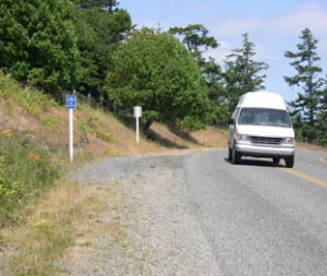
As a bicyclist, please do your part by following traffic laws. Ride defensively and wear appropriate high visibility clothing. We recommend that anyone planning to ride on island roads visit the San Juan County website for important information about road safety. Please use bike turnouts where you can pull off the road safely. Do not stop and rest on the road pavement, especially where you are not visible from both directions. Always wear a helmet.
Routes departing from Friday Harbor
There are three main routes with road shoulders leaving Friday Harbor to the following destinations on the island (all mileages are approximate):

Roche Harbor Road extends from Tucker Avenue to the northern part of the island ending at Roche Harbor Resort and Sculpture Park (9.2 miles).
Beaverton Valley road extends from Guard Street eventually becoming West Valley Road all the way past English Camp (8.2 miles), intersecting with Roche Harbor Road 1.3 miles beyond.
Cattle Point Road extends from Mullis Road south to American Camp (5.4 miles), South Beach (7.4 miles) and Cattle Point Light and DNR Interpretive Center (9 miles).

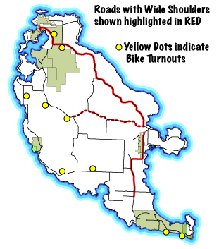
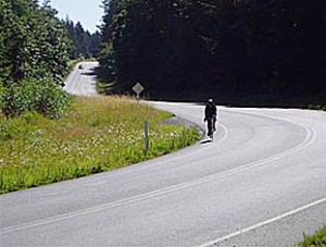
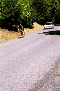
Each of these major roads have been improved over the years and have white fog lines as well as paved shoulders up to 3 feet in width. The widest shoulders are approximately 3′ wide along the entire length of Roche Harbor Road and also along Cattle Point Road as far as the intersection with False Bay Drive (4.2 miles) (red lines on the map). The shoulders are much narrower along Beaverton Valley Road and they go as far as the turnout at the crest of Cady Mountain (6 miles) which is a few miles beyond the intersection with Boyce Road (red dashed line).
Several popular island roads attract cyclists but do not have the width, fog lines or paved shoulders that allow for relatively safe and easy passing by vehicles. Use extra caution on the following routes:

San Juan Valley Road extending from Town to Boyce Road and intersecting Beaverton Valley Road. Douglas to Bailer Hill to Westside Road, and the very scenic and popular Mitchell Bay becoming Westside Road along the western coast. There are infrequent turnouts and numerous driveways where one can pull off but also long grades and sharp curves with shortened sight lines. These roads, especially in inclement weather or summer months with increased traffic, require special caution and defensive cycling.